


Farming has always been dependent on nature. Rainfall, temperature, pests, and soil conditions decide whether crops thrive or fail. But today, with the help of
Satellite Technology, farmers no longer need to depend only on guesswork. Satellites orbiting high above the Earth are giving us powerful insights into crop health, yield prediction, and even early warnings of crop distress.
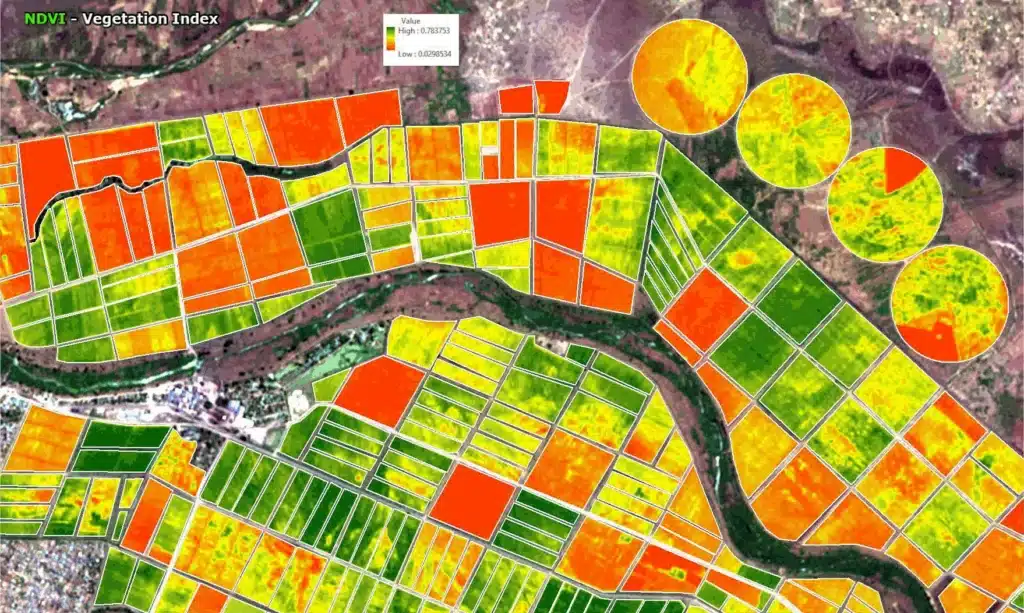
How Do Satellites “See” Crops?
Satellites don’t just take normal photographs. They capture light reflected from the Earth in different wavelengths – visible, near-infrared, and thermal.
- Healthy crops reflect more near-infrared light.
- Unhealthy crops reflect more red light.
By comparing these patterns, scientists calculate vegetation indices such as NDVI (Normalized Difference Vegetation Index). These indices help us understand whether crops are healthy, stressed, or at risk.
Predicting Crop Health and Yields
- Growth Monitoring – Satellite images taken regularly show how crops are growing across weeks and months.
- Yield Estimation – By combining satellite data with past yield records, soil quality, and weather data, we can estimate how much a field or region will produce.
- Stress Detection – Thermal sensors measure canopy temperature to detect water stress early, even before farmers notice wilting.
- Cloud-Proof Monitoring – Radar sensors can see through clouds, ensuring that crops are monitored even during the monsoon.
Preventing Crop Distress with Satellite Data
The real power of satellite data is not just in prediction but in prevention. Here’s how:
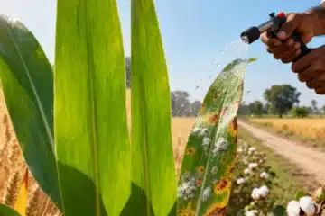
- Early Warning Systems: Sudden changes in crop color or canopy temperature can signal drought, pest attack, or nutrient deficiency. Farmers can be alerted in advance.
- Irrigation Management: Soil moisture maps help decide where and when to irrigate, saving both water and crops.
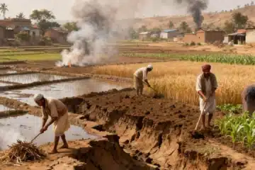
- Disaster Mapping: In case of floods, droughts, or hailstorms, satellites quickly show which areas are most affected. This helps in speedy relief and crop insurance claims.
- Pest & Disease Alerts: A drop in NDVI across a region, combined with weather conditions, can predict outbreaks. Farmers can take protective action before the problem spreads.
Benefits Beyond the Farm
- Government Planning: Accurate yield forecasts help in procurement and food security planning.
- Crop Insurance: Objective satellite data ensures faster and fairer claim settlements.
- Sustainable Farming: Biomass tracking through satellites supports carbon credit programs and sustainable agriculture practices.
The Way Forward
Satellites are not just for scientists or policymakers – their benefits can reach every farmer. When combined with mobile apps and advisory services, satellite insights can directly tell farmers when to water, fertilize, or protect their crops. This means fewer losses, better yields, and more security in farming.
At KrishiGK, we believe that technology like satellites should work for the farmer at the last mile, ensuring no crop is lost due to preventable distress.
Image reference from: https://s3.amazonaws.com/content.satimagingcorp.com/static/galleryimages/NDVI-Vegetation-Index-Soil-Moisture-2021.gif